Company Name
Rerouting the Metropolis
Revising the Street Plan
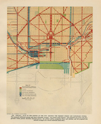
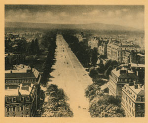
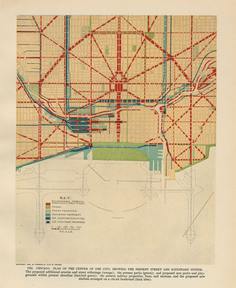
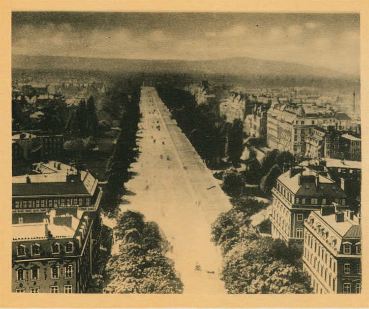
Burnham and Bennett's dramatic revision of Chicago's street plan anchored their efforts to make the city more efficient and attractive. The Plan of Chicago's sweeping scheme called for widening existing thoroughfares and adding new diagonals to route traffic around the city center, improve connections between neighborhoods, and provide easy access to new train stations and harbors. The scheme expanded the city's first boulevard circuit, laid out in the 1850s to link the major parks at what was then the edge of the city. The new boulevards would be beautiful, like the Parisian avenues that inspired them (below), but critics argued that the proposed removal of existing structures to make room for the new streets would be costly and disruptive.
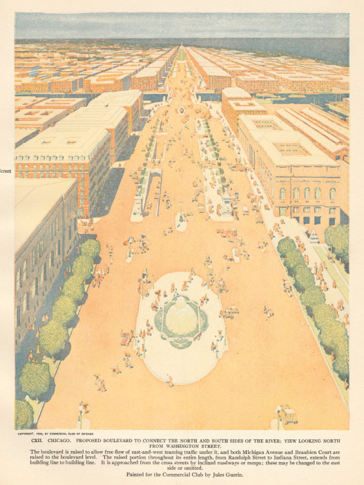
Fountains, statues, elegant architecture, and lush landscaping—these were all tactics the Plan of Chicago suggested to beautify thoroughfares such as Michigan Avenue (below). Diverting commercial and cross traffic to a lower level, out of view, would save the spacious upper boulevard for pleasure vehicles and pedestrians. The plan similarly envisioned Wacker Drive as a bi-level roadway.