Company Name
City and Region
The Region at a Glance
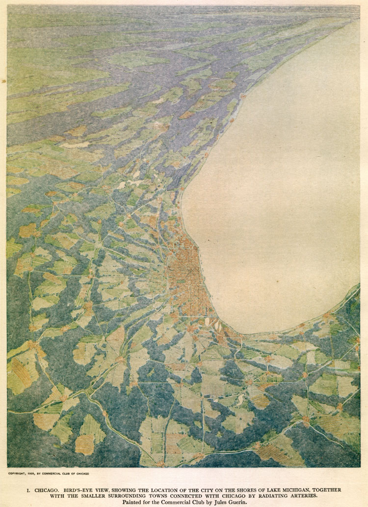
The ties binding a city and its surrounding region defy easy definition. One view, illustrated by Jules Guerin in the Plan of Chicago, foreshadows the way we see the Chicago area at a glance from modern airplanes: a populated place wrapping around the southern tip of Lake Michigan. But closer to the ground, we gain a more complex view of the region, reflecting an almost bewildering abundance of shared experiences and relationships.
This magnificent watercolor (left), which faced the title page of the Plan of Chicago, illustrates Burnham and Bennett's vision of the Chicago region. The bird's-eye view encompasses parts of Illinois, Indiana, Michigan, and Wisconsin, yet shows no political boundaries. Instead, it emphasizes the elements they believed bound the region together: its arteries of communication, natural landscape, and the great commons—Lake Michigan.
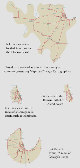
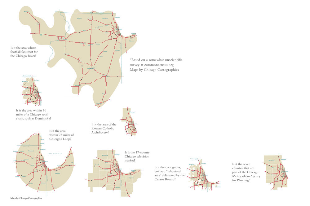
What does it mean to be part of a region? Most people claim allegiance to a great metropolis for social and emotional reasons—such as the location of a favorite sports team or the rituals of daily life. The maps below show seven different ways to see the Chicago region.
