Company Name
Planners and Reformers
Designing Gridded Cities
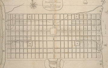
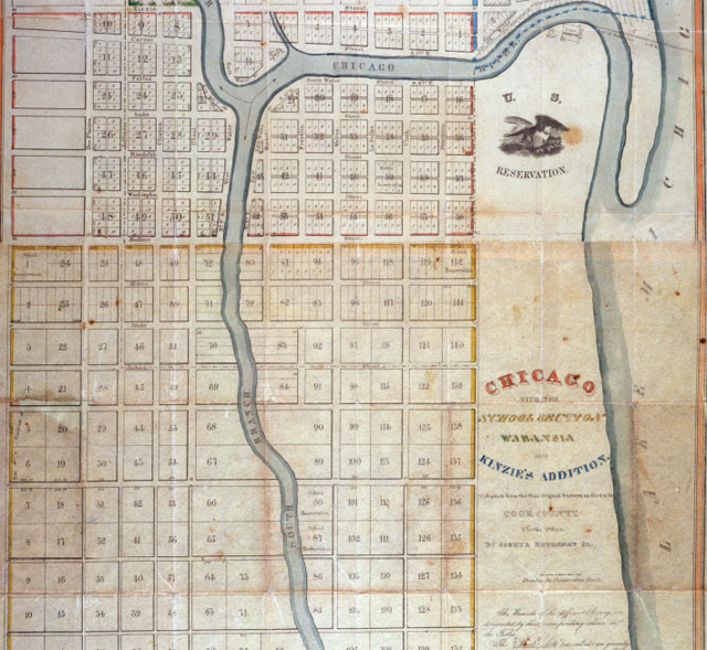
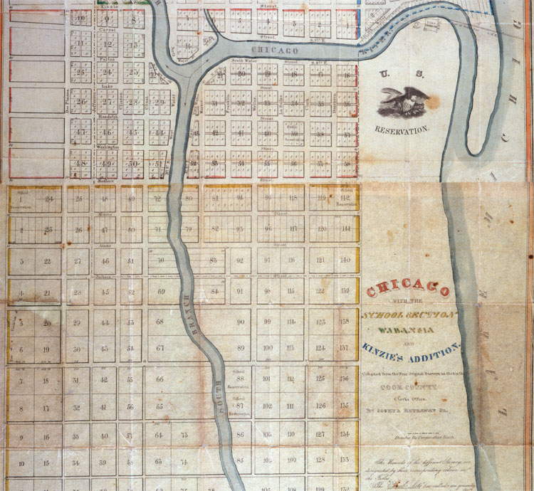
The Plan of Chicago extended an American tradition dating to colonial times of designing idealized yet practical cities. When Thomas Holme mapped Philadelphia for William Penn in 1683, they located the city strategically between two navigable rivers, the Delaware and Schuylkill. Philadelphia's orderly grid of streets established a model repeated across the country. Most of the Midwest has a regular, rectangular design, laid out by the federal government's General Land Office. Chicago's real estate developers subdivided this grid even further for efficient sales. The 1834 map, one of the earliest of Chicago, shows speculator John Kinzie's addition to the city's original 58 blocks. The grid served Chicago's meteoric growth into a city encompassing 190 square miles.