
Third of three
One of this year’s 20 Green Legacy Projects comes right out of the Plan of Chicago.
Daniel Burnham and his co-author Edward Bennett wrote that the entire Lake Michigan shoreline should be parkland, and the Last Four Miles initiative, promoted by The Friends of the Parks, wants to complete that vision.
Others, such as the Midewin National Tallgrass Prairie (below), fit easily into Burnham’s vision of the sort of wild open spaces where residents of the metropolitan region can go --- and need to go --- to escape urbanization and find the refreshment and tranquility of Nature.
Some, he would find odd, such as those that are re-using old railroad right of ways for bike and walking paths. In Burnham’s day, the railroad was a key engine of commerce. But he would have understood --- celebrated --- the desire to use these trails to link area to area. Indeed to weave the region into a single fabric.
The Green Legacy Projects, showcased by the non-profit conservation group Openlands, are being highlighted this year as a way of honoring the environmentally sensitive aspects of the Plan of Chicago, published a century ago in 1909.
Here, in alphabetical order, are those 20 projects:
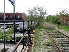 Bloomingdale Trail
This trail --- an elevated 2.75-mile linear park --- represents a new kind of green space. Only the second project of its type in the nation and the first in Chicago, the trail runs between the Chicago River and Central Park Avenue along a former railroad right of way through Chicago’s densely populated Near Northwest Side. When completed, the trail, overseen by the Trust for Public Land, will provide new and unusual recreational possibilities.
Burnham Greenway Gap
Closing this two-mile gap (below) in the Burnham Greenway, just west of Wolf Lake, would create a key junction for several trails of regional, state and national significance. Once the gap is closed, the greenway will link the Far Southeast Side of Chicago with the southern suburb of Burnham (which is named for Telford Burnham who laid out the property lines for the town in 1883, not for the much more famous Daniel Burnham). Even more, it will connect or make possible the connection of five regional trails, including the 500-mile Grand Illinois Trail which runs between Lake Michigan and the Mississippi River. “In the metropolitan region, it’s the most important gap that, if completed, would make all these things possible. It doesn’t complete the whole system, but this is the linchpin,” says Openlands executive director Jerry Adelmann.
.jpg)
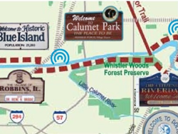
Calumet Open Space Reserve
The Calumet Open Space Reserve Plan is a blueprint for habitat restoration and recreation in the Calumet area on Chicago’s Far Southeast Side, an industrial region that is also home to high quality natural areas. Indeed, the area is increasingly recognized for its rivers, wetlands, woodlands and prairies. The City of Chicago has acquired more than 300 acres on which it will build the Ford Environmental Center, now being designed. A model of sustainable design and construction, it will provide educational programs on the industrial and ecological heritage of the Calumet area and the opportunities for the future.
 Calumet-Sag Trail
This planned 26-mile multipurpose east-west trail will run through and connect 14 south and southwest suburban communities. Following the Cal-Sag Channel, it will link the Centennial and Illinois & Michigan Canal trails on the west with the Burnham Greenway and Chicago Lakefront Trail on the east. Design and engineering studies are underway. Creation of the trail is being sponsored by the Calumet-Sag Trail Coalition, comprised of many agencies and organizations, including the Friends of the Calumet-Sag Trail and the National Park Service.
Chicago Riverfront Trail
Ten years ago, Mayor Richard M. Daley’s administration issued its Chicago River Corridor Development Plan, aimed at retrofitting the shoreline of the river with new green space and walking paths. This spring, a key element of the vision was completed with the opening of a section of walking path under the Michigan Avenue bridge. Now visitors can stroll from the bridge several hundred feet to the east and then come back, walk under the bridge and head all the way west to Wabash Avenue.
Deer Grove Preserve
Deer Grove Preserve, in northwest suburban Cook County, is the newest and 500th site in the Illinois Nature Preserve System. The Deer Grove Preserve is now nearly 1,800 acres of mixed upland savanna and related wooded wetlands which are home to numerous native plant and animal species, many of which are acknowledged as being rare in Illinois. Earlier this year, the Cook County Forest Preserve District and the Illinois Nature Preserves Commission dedicated approximately 1,035 acres of Deer Grove Preserve as an Illinois Nature Preserve and Nature Preserve Buffer.
Englewood New ERA Trail and Corridor Redevelopment
.jpg) A still-developing community plan in the Englewood neighborhood on Chicago’s South Side envisions a two-mile recreational path --- the New ERA (Englewood Re-making America) Trail --- along an unused elevated railroad right of way (similar to the Bloomingdale Trail). In addition, the plan, which is being created by several neighborhood organizations in conjunction with Openlands and the Local Initiatives Support Corporation, calls for a mural honoring local history and numerous pocket parks and gardens to enliven commercial and residential streets.
A still-developing community plan in the Englewood neighborhood on Chicago’s South Side envisions a two-mile recreational path --- the New ERA (Englewood Re-making America) Trail --- along an unused elevated railroad right of way (similar to the Bloomingdale Trail). In addition, the plan, which is being created by several neighborhood organizations in conjunction with Openlands and the Local Initiatives Support Corporation, calls for a mural honoring local history and numerous pocket parks and gardens to enliven commercial and residential streets.
Fox River Trail
The city of Aurora, the Kane County Forest Preserve District and other sponsors are planning an event this fall to break ground for completion of a 1.3-mile segment of the Fox River Trail in downtown Aurora. This segment is the final link in a 30-mile trail that is already one of the region’s most popular bike trails. The Fox River Trail runs the length of Kane County and then continues north through McHenry County (as the Prairie Trail) to the Wisconsin state line. Completing the final link in the Fox River Trail, as well as development of RiverEdge Park, are key aspects in Aurora's downtown revitalization program.
Hack-ma-tack National Wildlife Refuge
The proposed Hack-ma-tack National Wildlife Refuge is a two-state effort to protect a regional landscape rich in high quality biological resources in northern McHenry County (Illinois) and southern Walworth County (Wisconsin). A coalition of advocates from conservation organizations and agencies hope to create this refuge on 1,100 acres in northern McHenry County. Combined with the 3,273-acre Glacial Park holding of the McHenry County Conservation District, an area exceeding 4,000 acres would be created to protect an extraordinary collection of diverse natural communities and a dramatic glacial landscape while also improving recreational opportunities for local residents.
Kankakee Riverfront Trail
The first phase of this trail is being completed along the Kankakee River in the city of Kankakee. Ultimately, the multi-use trail will extend along the river from the Kankakee River State Park to the Wauponsee Glacial Trail (which will link Joliet and Kankakee) and to the Midewin National Tallgrass Prairie. The river represents a key open space and water resource for the southern part of the Chicago region.
Kankakee Sands
.jpg) The Nature Conservancy, other conservation groups and two state governments are working together on a long-term program for prairie and marsh protection and restoration. This region was originally covered by tens of thousands of acres of sand prairie, savanna and marsh lands, spanning the Indiana-Illinois border and generally following the Kankakee River. Today, most of the Grand Marsh has been drained, but the black oak savanna landscape survives and contains the largest concentration of high-quality sand savannas in the United States. More than 7,000 acres in Kankakee Sands is already protected. The 68-acre Carl N. Becker Savanna Nature Preserve was dedicated in April.
The Nature Conservancy, other conservation groups and two state governments are working together on a long-term program for prairie and marsh protection and restoration. This region was originally covered by tens of thousands of acres of sand prairie, savanna and marsh lands, spanning the Indiana-Illinois border and generally following the Kankakee River. Today, most of the Grand Marsh has been drained, but the black oak savanna landscape survives and contains the largest concentration of high-quality sand savannas in the United States. More than 7,000 acres in Kankakee Sands is already protected. The 68-acre Carl N. Becker Savanna Nature Preserve was dedicated in April.
Last Four Miles Initiative
In the Plan of Chicago, Daniel Burnham and co-author Edward Bennett envisioned parkland covering the city’s entire 30-mile lakefront. In 1909, only six miles of shoreline were parks. Today, it’s 26 miles. In June, Friends of the Parks issued a detailed plan for providing beaches and parks along the remaining four miles of shore, two on the North Side and two on the South Side.
Little Calumet River Trail
The Little Calumet River Trail is part of a 500-mile system of water trails designated specifically for non-motorized boating on ten of northeastern Illinois’ waterways. In addition to the Little Calumet, those waterways include the Des Plaines River, the Chicago River, Nippersink Creek, the Kishwaukee River, Salt Creek, the DuPage River, the Fox River, the Kankakee River and Lake Michigan. This system was proposed in 1999 when the Illinois Paddling Council, Openlands and the Northeastern Illinois Planning Commission drafted the Northeastern Illinois Regional Water Trails Plan. Today, it’s possible to paddle on just about all of the 500 miles of the system although additional work is needed to provide more access points for canoes, kayaks and other non-motorized craft.
Lockport-Joliet Heritage Park
The focus of the Heritage Park Plan is an eight-mile corridor from Isle a la Cache in the Des Plaines River, south through Lockport and Joliet. The goal is to preserve, restore and interpret the rich cultural and natural history of this area. This area contains early historical sites of industry and transportation that fueled the phenomenal growth of the Chicago metropolitan region in the late 19th century. Earlier this year, the north landing in Lockport was rededicated as Lincoln Landing. Also planned is the development of the Lockport Loop Trail.
Marquette Greenway Trail
The 50-mile Marquette Greenway Trail is a key component of the Marquette Plan, a strategy for lakeshore investment in northern Indiana that includes green space and trails for recreation, community development and the improvement of the environment. The goal of the plan is to recapture 75 percent of the Indiana lakeshore for public use. When completed, the trail will cross northern Indiana, linking shoreline communities and major parks from Illinois to Michigan. A high priority is a nine-mile segment called the Marquette Trail which will connect two sections of the Indiana National Lakeshore. A two-day sea kayak paddling event from Chicago to Michigan City, Indiana, was held in June to celebrate the water trail connections along formerly industrial lakefronts in South Chicago and northwest Indiana.
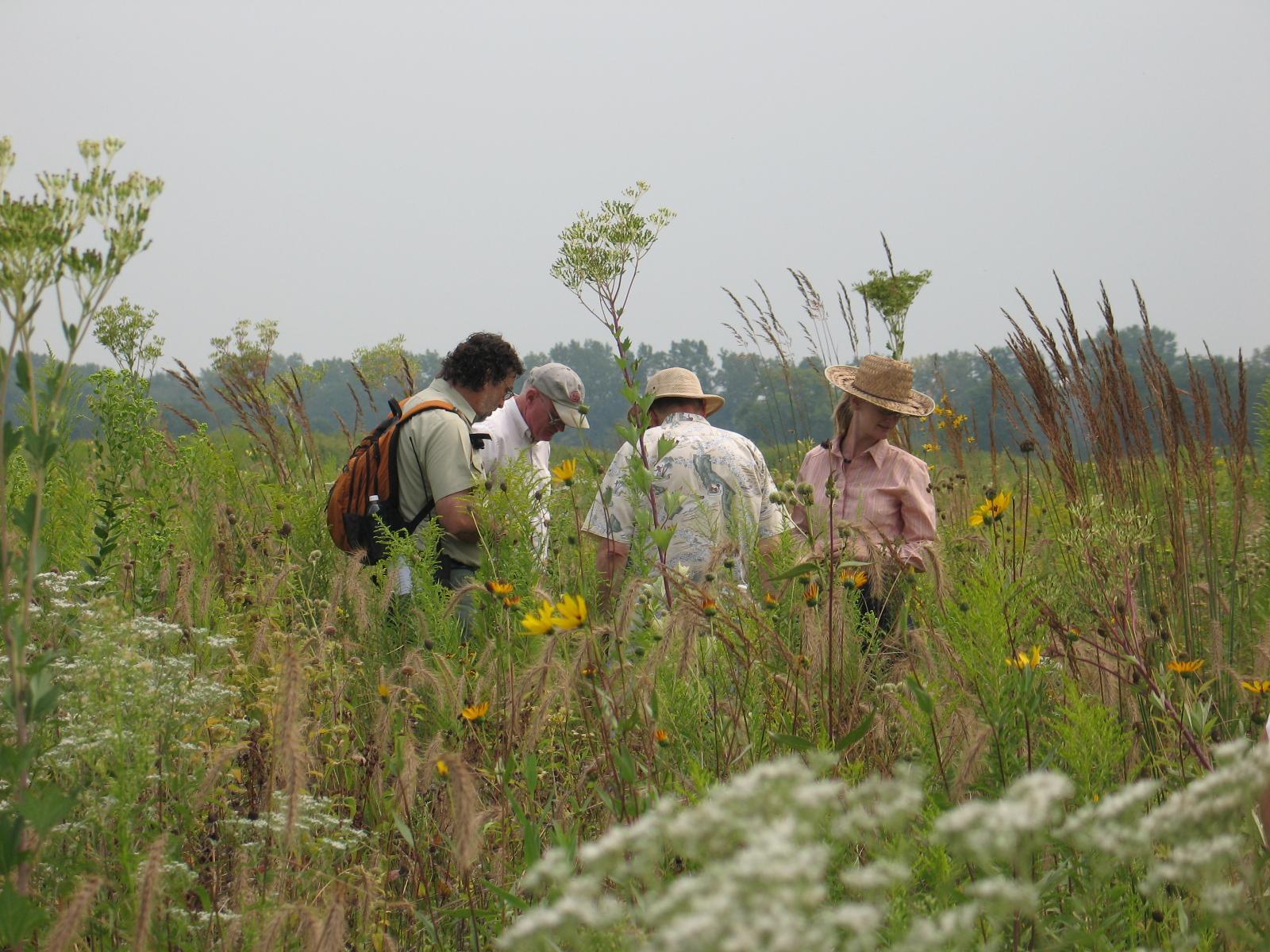
Midewin National Tallgrass Prairie
Once the location of the Joliet Arsenal, Midewin is the site of one of the most ambitious prairie restoration projects ever attempted. The largest protected open space in northeastern Illinois, the property is covers more land than Evanston, Skokie, Morton Grove and Wilmette combined. The restored prairie will provide habitat for a wide variety of wildlife as well as a look into the past --- a view at how the tallgrass prairie looked before the arrival of human settlement. The U.S. Forest Service is planning interpretive facilities and trails to improve access to the reserve.
Old Plank Road Trail
The Will County Forest Preserve District has completed the half-mile segment at the western end of the 21-mile Old Plank Road Trail. This links the trail to Joliet’s municipal bikeway system which, in turn, connects to the Illinois & Michigan Canal Trail. The trail passes through rare railroad prairie (Dewey Helmick Nature Preserve) and wetland habitat where more than 200 native plant species grown and at least 160 species of birds visit.
Openlands Lakeshore Preserve
Creation of the Openlands Lakeshore Preserve is an opportunity to restore one of the last remaining ravine/bluff ecosystems in the Chicago region. Environmentally sensitive public access will enable visitors to experience the Lake Michigan beach, rare ravine habitat and the spectacular views from the bluff overlooking Lake Michigan. The Preserve is the southern half of a two-mile stretch of the Lake Michigan shore made available by the de-commissioning of Fort Sheridan in Lake County. The northern half was transferred to the Lake County Forest Preserve District in the 1990s; the southern half was transferred to Openlands in 2004. Scientific studies of the hydrology, ecology and geology of the site have been conducted as the basis for the Preserve's Action Plan. Bluff and ravine restoration programs are now underway.
Rock Run Greenway
The nine-mile Rock Run Greenway consists of 1,200 acres of high quality wetlands and a trail in the Joliet-Lockport area. The Will County Forest Preserve District has acquired the Theodore Marsh, the last available and unprotected gap in the greenway. The Greenway trail forms a loop that connects to the Illinois & Michigan Canal Trail and the Grand Illinois Trail.
Waukegan Open Space
The city of Waukegan is implementing its master plan, entitled “A 21st Century Vision for Waukegan’s Downtown and Lakefront.” The plan, covering 1,400 acres, includes recommendations and strategies for downtown revitalization, the transformation of the adjacent formerly industrial lakefront to residential uses and the creation of 700 acres of open space. The objective of the open space component is protection and restoration of rare habitat and the provision of appropriate, enhanced public access. An important initial step will be the development of beach access facilities, including a boardwalk that will provide a better way to reach the shore and also better protection of the rare and fragile dune and swale ecosystem.
For a print-friendly version of this post, go here.
Blog Categories
- art (14)
- civic engagement (17)
- culture (16)
- future (26)
- green legacy (15)
- history (26)
- pavilions (4)
- schools (8)
- transportation (7)