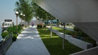
On June 19, 2009 the City of Chicago opened the first section of the Chicago Riverwalk—between Michigan Avenue and Wabash Avenue and under the Michigan Avenue bridge. By retrofitting the riverfront to give pedestrians direct river access and green space in the heart of downtown, Chicago’s Green Legacy Project is advancing the next generation of public shoreline—the river’s edge—to provide health and recreation as well as aesthetic and economic development benefits. The Michigan Avenue Bridge designed by Plan of Chicago co-author Edward Bennett is a major legacy of the Plan, and the under-bridge connection ushers in a new era of connected public space.
The Burnham Plan Centennial year is also the 10th anniversary of the "Chicago River Corridor Development Plan," a plan for public and private development along a highly diverse 22-mile river corridor running through one of North America’s densest urban areas. The plan also achieves the two Green Legacy goals of connecting us to our rivers and streams and expanding neighborhood green space by creating public access to the river’s edge via a continuous greenway along at least one bank. Protecting and restoring riverbank landscaping and pre-development natural habitat will promote economic development and enhance quality of life along a once-industrial Chicago River.
For a print-friendly fact sheet on the Chicago Riverfront Trail, click here.
City of Chicago
Contact: Michelle Woods, miwoods@cityofchicago.org, 312.744.4834


