
Daniel Burnham was depressed.
The man known as “Uncle Dan” to his fellow architects and urban planners was someone who, through force of personality and a huge well of optimism, inspired confidence in clients, employees and co-workers. He was, acknowledged his critic Louis Sullivan, “a man of fixed determination and strong will.” He worked well with others.
.jpg) Here was a man who hobnobbed with the elite of Chicago. Indeed, he was a member of that elite. But he also was on good terms with less savory (but nonetheless powerful) characters such as First Ward Aldermen Mike “Hinky Dink” Kenna and “Bathhouse” John Coughlin, members of the corrupt Gray Wolves faction of the City Council. Coughlin liked Burnham so well that he named one of his racehorses “Dan Burnham.”
Here was a man who hobnobbed with the elite of Chicago. Indeed, he was a member of that elite. But he also was on good terms with less savory (but nonetheless powerful) characters such as First Ward Aldermen Mike “Hinky Dink” Kenna and “Bathhouse” John Coughlin, members of the corrupt Gray Wolves faction of the City Council. Coughlin liked Burnham so well that he named one of his racehorses “Dan Burnham.”
But, on this afternoon in July, 1906, when Charles Dyer Norton and Frederic A. Delano strode into his office in the Railway Exchange Building (now the Santa Fe Building), they found a despondent Burnham sitting at his desk and staring out across the broad expanse of Lake Michigan.
Norton and Delano had come to tell him that the members of the Merchants Club just that afternoon had agreed to come up with $20,000 so that Burnham could begin work on a comprehensive plan for Chicago.
“It is wonderful, Charles,” Burnham said, “but I am afraid it is no use. My doctor has just been here to tell me that I have a mortal disease --- that I have at most three years to live.”
The news stopped the two visitors cold, Norton later wrote in a 1922 history of the Merchants Club, but Norton couldn't help himself and blurted out, “But, Mr. Burnham, that is just time enough; it will take only three years.”
Startled, the great planner stared at Norton. “[T]hen he broke into a laugh and said: 'You are right. I will do it.' ”
On such intensely human moments, history hinges.
International impact
When Burnham agreed to take up one final great task in a life that had been filled with large challenges, he began a process that would be a turning point in urban history in the U.S. and across the globe. After three years of work with his right-hand man Edward Bennett and a team of artists and draftsmen, Burnham produced the Plan of Chicago, published on July 4, 1909.
This year, in celebration of the centennial of the Burnham Plan, as it is commonly called, scores of civic groups and institutions --- from Openlands to the American Planning Association, from the Addison Public Library to De Paul University, from the National Museum of Mexican Art to the Morton Arboretum --- are sponsoring hundreds of activities to raise awareness about the impact of the Plan and about planning for the Chicago region’s future.
.jpg) The Plan became a blueprint for the transformation of metropolitan Chicago. It resulted in a city that was healthier, more efficient, more beautiful, less congested and less claustrophobic.
The Plan became a blueprint for the transformation of metropolitan Chicago. It resulted in a city that was healthier, more efficient, more beautiful, less congested and less claustrophobic.
But its impact was also international.
It was the first attempt at creating a comprehensive plan for a city and its region, and became a model for such documents in municipalities, large and small, worldwide. It was, writes Carl Smith in his 2006 book “The Plan of Chicago: Daniel Burnham and the Remaking of the American City” (University of Chicago Press), the single most important step in the development of urban planning as a respected profession and in the recognition that an essential role of municipal governments is to anticipate, plan for and shape the future.
Not all experts agreed with the Plan’s emphasis on the central business district and on the built environment. Indeed, because of Burnham’s top-down approach, prominent Chicago architect Stanley Tigerman has called him “the anti-Christ of democratized planning.”
Yet, Smith notes, “Whether planners after Burnham looked to his work with admiration or disapproval, they universally acknowledged his crucial role in establishing their calling and advancing its status.”
+ + + + + +
If you live in Chicago, you live in the Burnham Plan. If you come to Chicago for a visit, you are going to be in the middle of the Burnham Plan almost everywhere you turn.
And not just when you’re in the city.
Say you’re driving in from Dixon along Interstate 88. As soon as you hit Veterans Memorial Tollway (Interstate 355) as you head through Downers Grove, you’re driving through the Plan.
Across from page 40 in the Plan of Chicago (at least two facsimile editions are in print) is a colorful map titled “General Diagram of Exterior Highways Encircling and Radiating from the City.” It looks a lot like the present-day highway-expressway-tollway system that you’re driving through. It’s almost as if Burnham and his colleagues had today’s highway map up on their wall when drawing up their own --- except that the Plan’s network is more complete.
“It needs no argument,” Burnham wrote, “to show that direct highways leading from the outlying towns to Chicago as the center are a necessity to both; and it is also apparent that suburban towns should be connected with one another in the best manner.”
“Run away…back into the wilds”
Perhaps your first stop is to see a friend in La Grange, so you head south on Mannheim Road --- after you go a few miles, the name changes to La Grange Road --- and you notice on your left and then on your right that you’re passing vast acres of land thick with trees: Brezina Woods, then Possum Hollow Woods, then La Grange Park Woods.
These woods and the rest of the 68,000-acre Cook County Forest Preserve District are direct results of the Plan. And they, in turn, have spawned forest preserve districts in the other six counties that ring Chicago like a collar: Lake, McHenry, Kane, DuPage, Kendall and Will.
 The idea of a Cook County Forest Preserve District had been kicking around for several years, but it wasn’t until the Plan was published that the political will developed to make it a reality. On a two-page map following page 44 in the Plan, you can see Burnham’s vision for huge preserves of wild, open, natural areas, not only in Cook County but also further west in DuPage County. And, a few pages later, you can read his rationale:
“Natural scenery furnishes the contrasting element to the artificiality of the city. All of us should often run away from the works of men’s hands and back into the wilds, where mind and body are restored to a normal condition, and we are enabled to take up the burden of life in our crowded streets and endless stretches of buildings with renewed vigor and hopefulness….He who habitually comes in close contact with nature develops saner methods of thought than can be the case when one is habitually shut up within the walls of a city.”
After your La Grange visit, you head back up north and get on the Eisenhower Expressway (Interstate 290), heading east. And you’re in yet another aspect of the Plan…sort of.
Burnham’s Plan had called for the redevelopment of what was then known as Congress Street as a stately avenue to serve as the city’s main east-west roadway. But when that street was finally redeveloped in the 1950s as the high-speed Congress Expressway (later re-named for President Dwight D. Eisenhower), the road bore little relation to the planner’s genteel vision. Yet, it is, without question, the city’s main east-west roadway.
The Eisenhower is a reminder that not all of the ideas in the Plan of Chicago were brought to fruition.
Consider the mammoth, looming Civic Center that Burnham wanted to plop down at the intersection of Halsted and Congress Streets. For all the beautiful watercolors of it and Burnham’s rhapsodic prose, the idea --- luckily --- never caught on. Not only would the domed structure have wiped the immigrant area served by Jane Addams’s Hull House settlement complex, off the city’s map, but it would also have shifted government-related development away from the Loop, weakening the central business district.
Not exactly as Burnham envisioned
As you continue to head east and cross over the Chicago River, you go under the gargantuan former U.S. Post Office building. The Eisenhower changes into Congress Parkway and cuts across the South Loop until, at Michigan Avenue, you find yourself driving into Grant Park.
Perhaps no location in Chicago is more identified with the Plan of Chicago than is Grant Park, the city’s elegant front yard and its meeting place to celebrate everything from great food to great music to the election of a local hero to the presidency of the United States.
This, however, is another case in which the end result is not exactly as Burnham envisioned it.
A century ago, Grant Park was a vast stretch of ugly, empty, un-landscaped acreage, bisected north-south by a thick cluster of railroad tracks. Those tracks made it difficult to get from the Loop to the east side of the park, and the barrenness of that eastern area made it difficult to see any reason to make the trek.
Looking down on the park from the roof of the Railway Exchange Building where, in a specially constructed workshop, his team was drafting the Plan, Burnham superimposed on the scene his own vision --- the park as a garden to serve as the setting for “the intellectual center of Chicago.” In his mind’s eye and later in the watercolors of Jules Guerin, Burnham saw three institutions dominating the park. One, the Art Institute of Chicago, was already there in the park but would be moved to a new structure at the north end. It would be joined by a new building for the Crerar Library on the south end and by a new massive, looming Field Museum in the center.
It wasn’t to be.
In 1911, two years after the publication of the Plan, department store magnate Aaron Montgomery Ward won a decisive ruling from the Illinois Supreme Court, banning new buildings in Grant Park. (The Art Institute, constructed there in 1892, was permitted to remain.) Ward had been waging a series of legal battles to protect the park as a park, arguing that an 1836 land map prepared by the Illinois and Michigan Canal commissioners designated it as “public ground forever open, clear and free of any buildings.” Finally, after four lawsuits and 21 years of effort, the high court agreed.
So Burnham must share with Ward the honors for transforming Grant Park from what it had been to what it is today.
“The Lake is living water…”
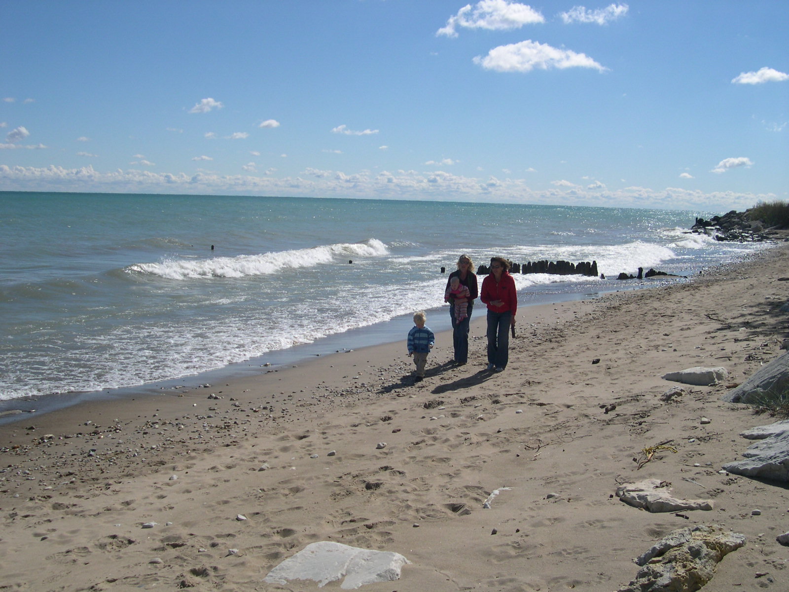
Yet, he stands alone as the father of Chicago’s unique --- and uniquely beautiful --- lakefront. In 1909, only six miles of the 30-mile Lake Michigan shoreline were parkland. Today, 26 miles are, thanks to Burnham’s vision. Where other cities have factories and warehouses, rendering plants and garbage dumps, Chicago has a lake shore filled instead with softball diamonds, bike paths, quiet glens, beaches, harbors, picnic areas, promontories, playgrounds and soccer fields.
“The Lake front [sic] by right belongs to the people,” Burnham wrote, adding, “Not a foot of its shores should be appropriated by individuals to the exclusion of the people.”
Through the Plan and his own vibrant language, Burnham established, as a key principle of Chicago civic policy, the goal of claiming --- and, in some cases, reclaiming --- the natural wonders of the lakeshore for the health, well-being and enjoyment of all Chicagoans.
 For Burnham, there was something transcendent about Lake Michigan, and, in the Plan, he communicated his sense of awe through descriptions that bordered on poetry: “The Lake is living water, ever in motion, and ever changing in color and in the form of its waves. Across its surface comes the broad pathway of light made by the rising sun; it mirrors the ever-changing forms of the clouds, and it is illumined by the glow of the evening sky. Its colors vary with the shadows that play upon it. In its every aspect it is a living thing, delighting man's eye and refreshing his spirit.”
Much else resulted from the Plan of Chicago, including the development of the Near North Side and creation of Michigan Avenue as the Magnificent Mile; the creation of Navy Pier, later to become the city’s great tourist attraction; and the construction of the double-deck, boulevard-like Wacker Drive, a proto-highway that allowed traffic to zip around the edge of the Loop and provided a lower-level where deliveries could be made without clogging downtown streets.
But the lakefront --- the envy of cities around the world, a source of beauty, relaxation and renewal to generations of Chicagoans --- is Burnham’s greatest legacy.
+ + + + + +
Burnham was not alone in creating the Plan of Chicago. And, because he died three years after its publication, the decades-long effort to implement the Plan’s ideas was the work of many people.
Take a look at the title page: Burnham and Edward Bennett are listed as authors. Charles Moore, formerly a political aide to a U.S. Senator from Michigan, is identified as the book’s editor. There’s also the indication that the Plan was “prepared under the direction of The Commercial Club.” (The Merchants Club, shortly after hiring Burnham in 1906, merged with the Commercial Club.)
On the facing page is a graceful watercolor showing the Chicago region (conspicuously without political boundaries) as if seen from the edge of space. That’s by Jules Guerin who produced dozens of watercolors for the book. But, as newly public documents from Bennett’s archives show, it was based on two of Bennett’s sketches.
Sunday evening meetings
Bennett (below, right), who was in his early 30s when Burnham tapped him in 1906 to work on the Plan, is often overlooked in discussions of the document. But, day to day, for three years, he was the project manager who oversaw the work of the team of artists, draftsmen and others putting the Plan together. Burnham, who travelled twice to Europe during that period and continued to deal with his architectural firm’s clients, checked in regularly with Bennett.
.jpg)
“When Burnham was not immediately available, Bennett often acted as his intermediary, though Burnham remained unquestionably in charge,” writes Carl Smith. “Bennett, who lived several towns north…in Lake Forest, sometimes stayed over at Burnham’s [Evanston] home on Sunday evenings so they could talk about progress to date. They would continue their conversation on the way into Chicago the next morning.”
Following the publication of the Plan and Burnham’s subsequent death, Bennett played a key role, as the consulting architect to the Chicago Plan Commission (1913-1930), in turning the document’s ideas into concrete and steel realities. He also wrote Chicago’s first zoning law.
Also essential in the implementation work was Charles H. Wacker, the brewery heir who served as the chairman of the Plan Commission from 1909 to 1926. Establishment of the 328-member Commission in November, 1909, by Mayor Fred Busse was arguably the most significant result of the Plan. For three decades, the Commission worked to build public and political support for Plan-related projects.
For instance, Walter Moody, the Commission’s managing director, oversaw a multi-dimensional, long-running public relations campaign that included a flood of pamphlets, a lantern-slide lecture series, a two-reel movie and his masterpiece, “Wacker’s Manual of the Plan of Chicago.” The manual, written by Moody, was used in the Chicago public schools as a required eighth-grade civics textbook for more than half a century. Undoubtedly, many of the Chicagoans who approved the 86 Plan-related bond issues had learned the details --- and importance --- of the Plan from their children, or had studied the Wacker Manual themselves as youngsters.
Of course, in Chicago, nothing ever happens without the approval of the political leaders, such as Mayor Big Bill Thompson, but, for them, backing the Plan was “a no-lose proposition,” writes Douglas Bukowski in his 1997 book “Big Bill Thompson, Chicago, and the Politics of Image” (University of Illinois Press).
“The working class got jobs,” Bukowski writes, “and the business class got the public works they wanted. For Thompson, city planning meant power. He knew that politicians would control contracts, jobs, start-up times, and completion dates.”
“His vision and energy”
So, from Bennett to Wacker to Thompson, there were many people who were important in the creation and implementation of the Plan.
But it’s called the Burnham Plan for a reason. It was Burnham who played the main role in gathering, analyzing and synthesizing the myriad ideas for improving the Chicago region, many of which had been discussed in one form or another for years. And it was Burnham who, in late 1908, sat down and, writing in pencil, composed a 310-page first draft of the document.
In her introduction to a 1993 reprinting of the Plan, architectural historian Kristen Schaffer credits Burnham’s “genius” for the Plan --- “his vision and his energy,…his ability to see how all the elements of the city and its functioning are related and his tenacity in making others see it as well.”
And she adds, “Despite the thousands of hours contributed by others, it was referred to at the time as ‘the Burnham plan.’ ”
+ + + + + +
This year’s celebrations of the 100th anniversary of the Plan of Chicago are being spear-headed and coordinated by the Burnham Plan Centennial, an arm of Chicago Metropolis 2020. That business-based organization is itself an offshoot of the same Commercial Club of Chicago that, a century ago, commissioned the Burnham Plan.
The goal of all the parties and programs isn’t to wallow in urban planning nostalgia, says George Ranney, the president and CEO of Chicago Metropolis 2020.
It’s to change the future.
"I don't see that this is justified as a celebration if it doesn't lead to results," Ranney says.
Chicago Metropolis 2020 led the successful effort several years ago to create and fund the Chicago Metropolitan Agency for Planning (CMAP). A key provision in that legislation was to give the new agency the power to prioritize transportation projects. That means --- in theory, at least --- that it will determine which projects get federal funding and which don’t.
In other words, CMAP is the first regional planning group for the Chicago region that will not only propose ideas but will have the political clout to implement them.
The future of the future
Of course, given the slash-throat, take-no-prisoners nature of politics in Illinois, nothing is certain. But the agency is well on its way toward creating the first comprehensive plan for the city and suburbs that will integrate issues such as transportation, housing, open space and the environment. It’s called GO TO 2040.
In contrast to Burnham’s top-down approach to planning, CMAP is bending over backwards to solicit and incorporate the ideas of anyone and everyone through workshops and other public presentations as well as providing online tools with which Chicago and suburban residents can comment and vote on how they would like the future to look.
If successful, GO TO 2040 will transform the Chicago region, just as the Burnham Plan did.
“We don’t pretend to be Daniel Burnham,” says Randy Blankenhorn, the CMAP executive director. “However, we do want to live in that spirit. We do want to be bold….It scares us a little. The expectations are incredibly high. But I think that’s what people want. They want a new way of thinking. They want to think about their region in a different way.”
A century after its publication, the Plan of Chicago, the Burnham Plan, remains a living document --- and an inspiration for those who look to the future and dream.
This article was originally published in the September-October 2009 issue of Illinois Heritage, the magazine of the Illinois State Historical Society
For a print-friendly version of this post, go here.
Blog Categories
- art (14)
- civic engagement (17)
- culture (16)
- future (26)
- green legacy (15)
- history (26)
- pavilions (4)
- schools (8)
- transportation (7)