
First of two
For anyone who knows the history of Chicago, it’s jarring to hear Michelle Woods say, “We want to embrace the river.”
A century ago, when Daniel Burnham and his colleagues produced the Plan of Chicago, they looked to Lake Michigan to find Nature and to beautify the city.
The Chicago River? Well, it was the river --- which, in that era, meant an open sewer.
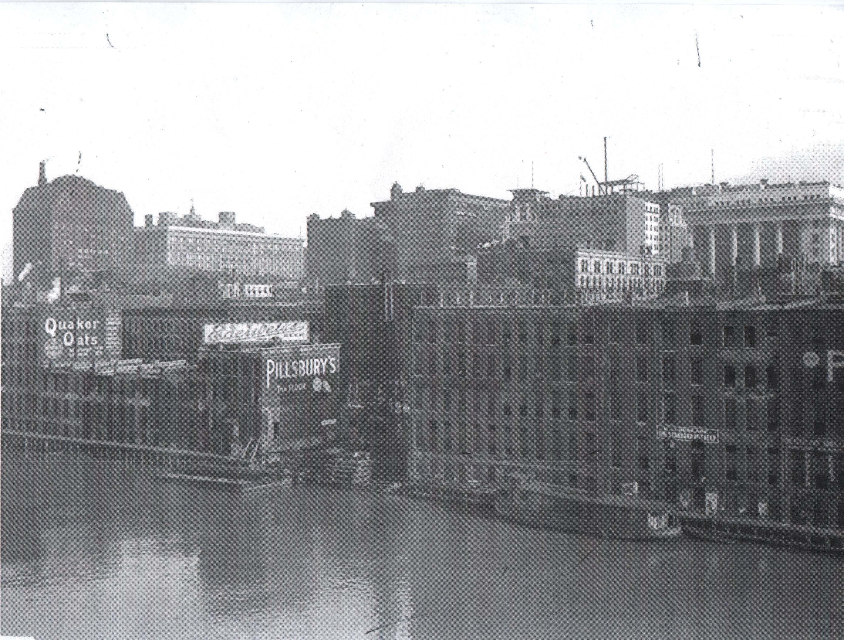 “In the city’s early boom years, the main stem of the river was crowded with schooners and steamer ships loaded with goods, while sewage and byproducts from the slaughterhouses, sawmills and tanneries fouled its waters.”
That description is from the city’s 2005 Chicago River Agenda, and, to underline the point, Mayor Richard M. Daley leads off the report with a short letter in which he notes, “In his famous book The Jungle, Upton Sinclair exposed the dark side of development on the river and the industrial pollution fouling the water.”
Mayors don’t usually talk about foulness in their cities. And Mayor Fred Busse certainly wouldn’t have been issuing reports back in Burnham’s time on the smelly, unhealthy river working its way through the central business district.
Daley’s point is to contrast the waterway then with the much less polluted, much more inviting one of today.
And that’s why Woods can talk now of “embracing” the river.
Woods is the Chicago Transportation Department project manager overseeing the development and construction of the Chicago Riverwalk, one of the 20 “green legacy” projects that are being highlighted as part of the celebration of the 100th anniversary of the publication of the Burnham Plan.
“The Chicago River is a beautiful natural resource,” Woods says. “We’re trying to make as much of the river as accessible as possible.”
Kerplunk
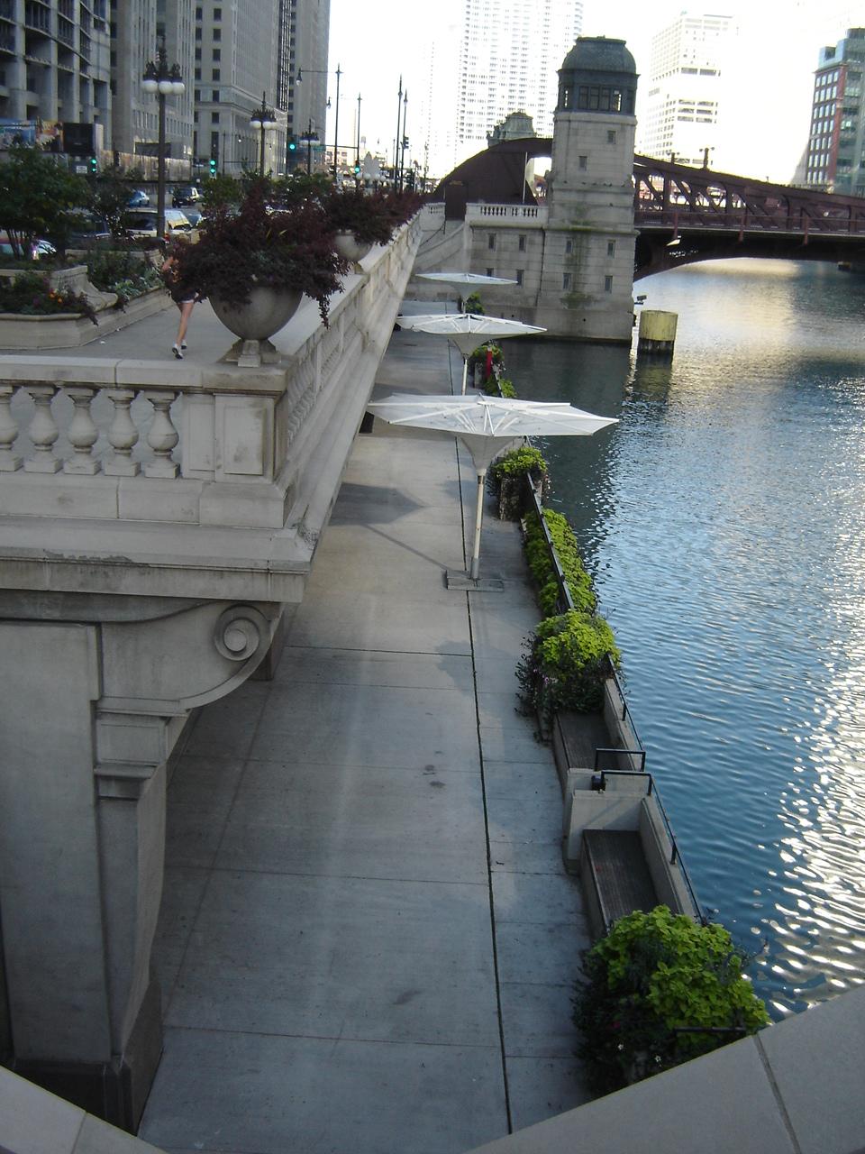
The goal is for the riverwalk to stretch about a mile and a third along the south bank of the river’s main channel from Lake Michigan to Lake Street.
.jpg)
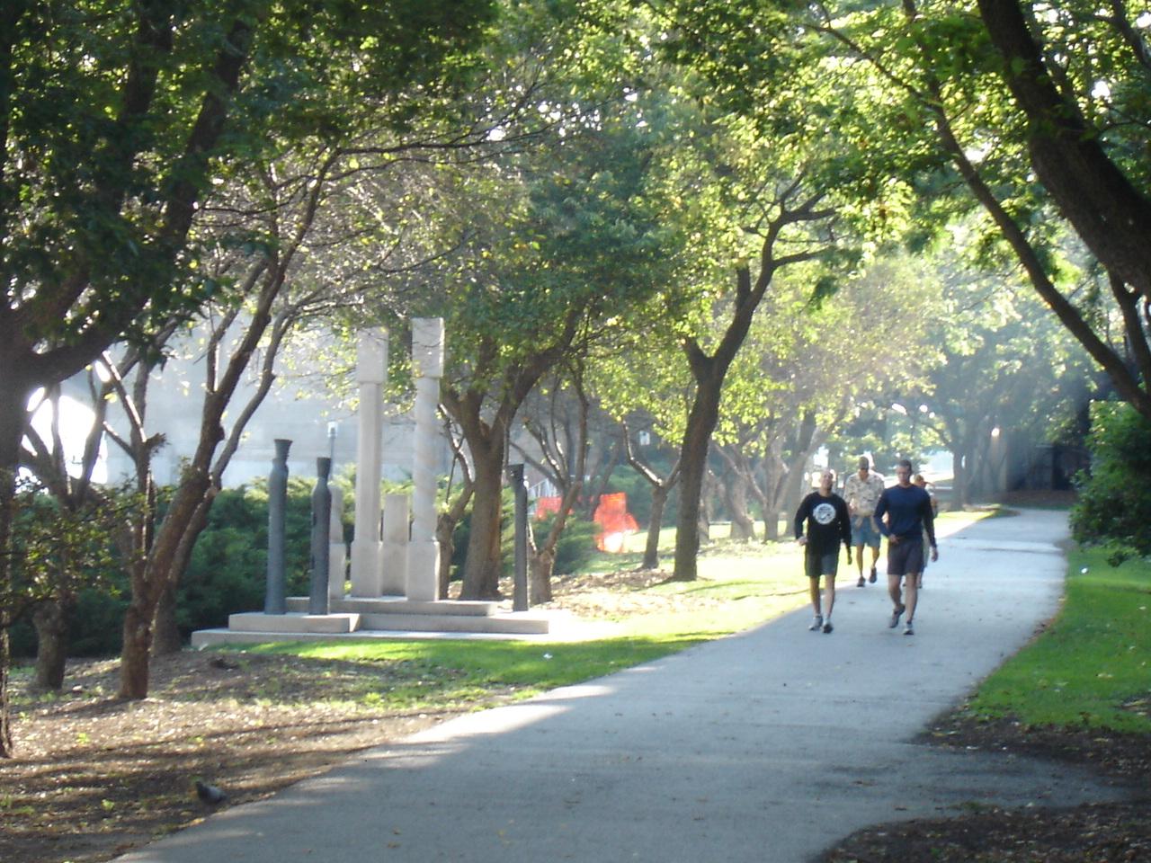
And, already, more than half of that walk is finished and open to the public --- stretching unbroken between State Street and a spit of land just east of Lake Shore Drive (above).
Fathers pushing strollers along the shore can hear the kerplunk of a leaping fish in the river’s cleaner water. Back in 1974, only 10 species of fish could survive in the waterway. Today, there are nearly 70, including largemouth and smallmouth bass, rock bass, crappie, bluegill, catfish, carp and crayfish.
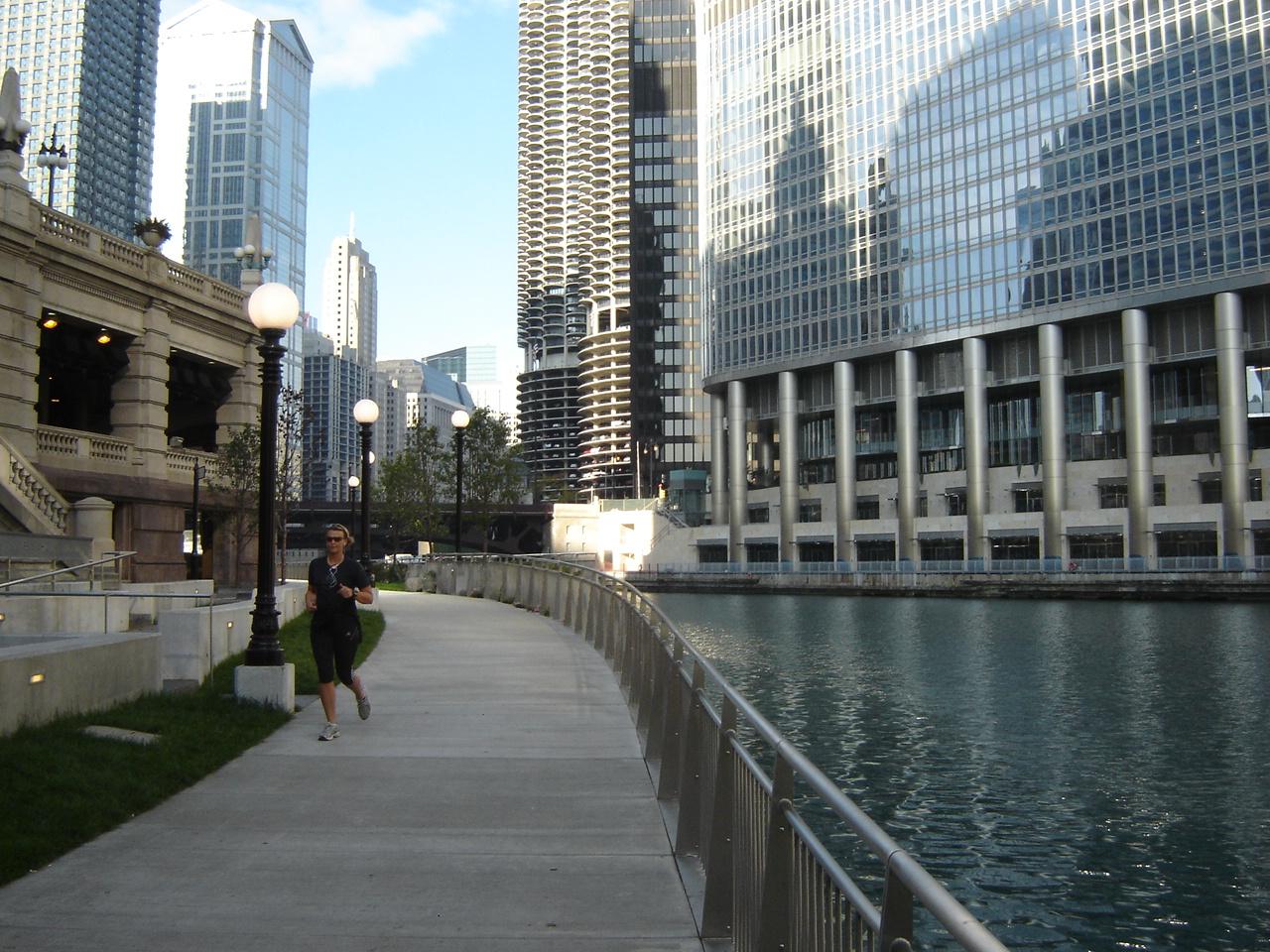
Joggers move along a path that meanders through a ribbon landscape of trees, grass and flowers with, at present, only a few commercial operations --- boat tour booths and restaurants.
Tourists and office workers come to stroll or picnic, and watch the river slowly move its way westward to Wolf Point where it turns south to the Mississippi and ultimately the Gulf of Mexico. Burnham wrote about the “living water” of Lake Michigan, but the phrase holds true today for the river as the sun plays across its rippling, ever-moving, ever-changing surface.
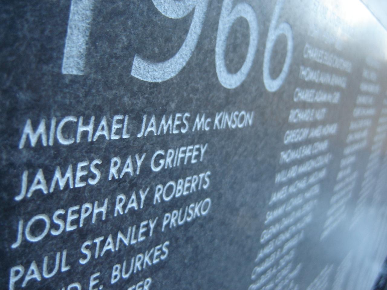 Between Wabash Avenue and State Street, visitors find the Vietnam Veterans Memorial Plaza (left), dedicated in 2005. One of the largest Vietnam War memorials outside of Washington, D.C., the plaza features a long black granite slab listing the names of nearly 3,000 Illinois residents killed in action or listed as missing during the conflict.
“It’s a quiet place for reflection,” says Woods.
The river provides a meditative presence, away from the bustle of traffic just above, for the relatives and friends of those lost. “You can go down there and have an appropriate memorial service,” Woods says.
This is also the location of a ramp which makes the riverwalk accessible to people in wheelchairs.
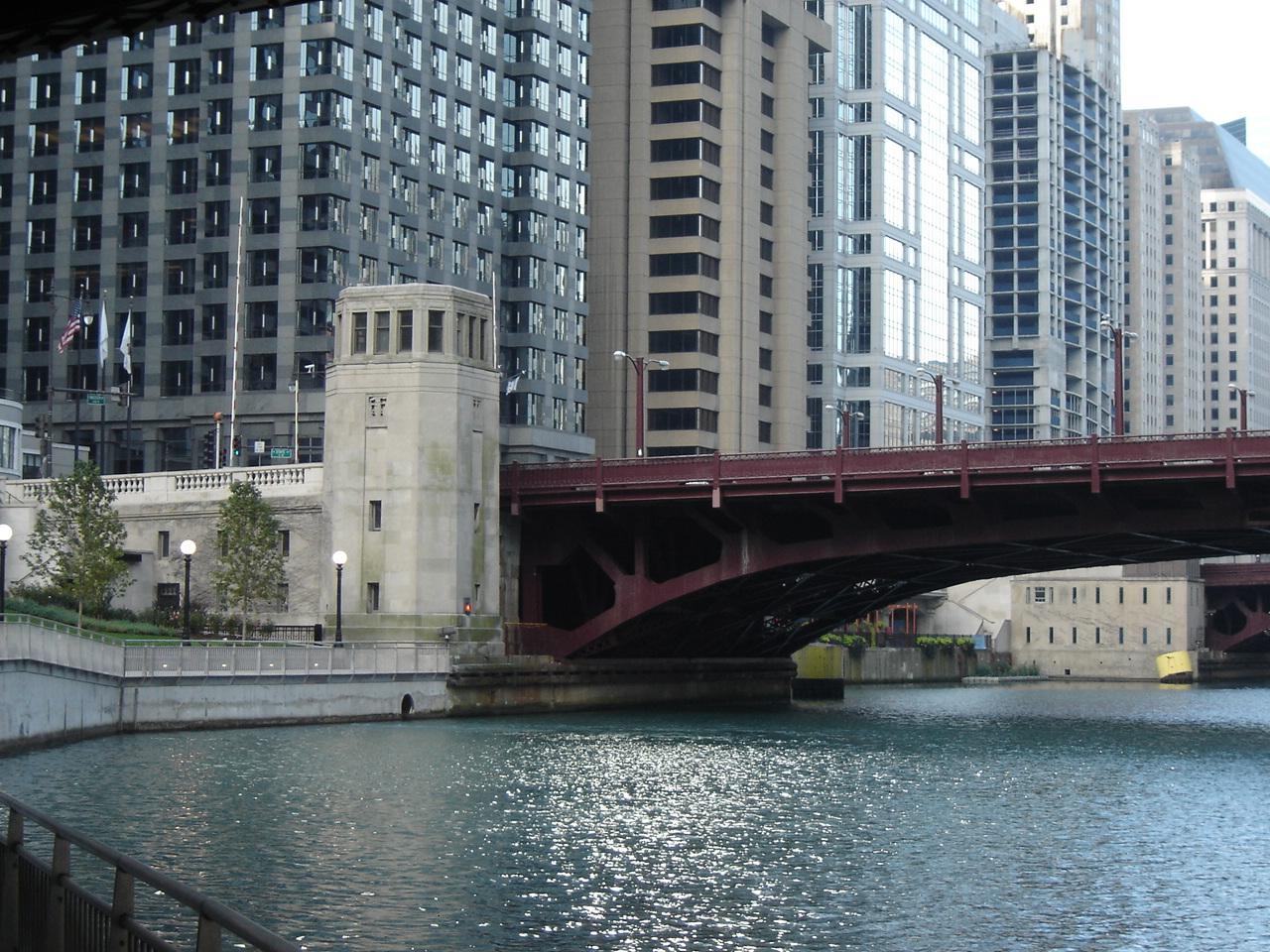
The path has been open from State Street for only a couple months --- since the completion of the walkway under the Michigan Avenue bridge in June and the one under the Wabash Avenue bridge in July, a double-barreled project that cost about $22 million.
A segmented shoreline
Next up, whenever the money is available, is stretching the path another two-thirds of a mile west to Lake Street.
This would involve linking six isolated segments of shoreline.
 Five of these were developed in 2004 and are now open for public use. They are between the bridges at State, Dearborn, Clark, LaSalle, Wells and Franklin Streets. But the only way to get from one to the other is to climb up and down long flights of stairs.
The sixth segment is between Franklin and Lake Streets. It is an open shoreline but hasn’t been upgraded for public use. Although there is a stairway there, a padlocked gate at the top bars entry.
The problem is the bridges.
The bases of the bridges already stick out into the river, and any path under them would further reduce the width of the waterway.
“The general opinion of the Coast Guard and the Army Corps of Engineers is that the river was here first. Navigation of the water takes precedence,” explains Woods. As a result, the path under the bridge can only be 20 feet wide at the most. At Michigan Avenue, it was limited to 17 feet because of the turn in the river there.
 The path has to go under the six bridges, so extending it involves negotiating how wide each under-bridge section will be --- and finding the money to pay for the construction.
Woods says that, while it would be more efficient to build the path under all six bridges at once, the city is probably going to have to do the work in stages as money becomes available.
“We’d like to build as far west as we can,” she says.
Next: The other riverwalk
For a print-friendly version of this post, go here.
Blog Categories
- art (14)
- civic engagement (17)
- culture (16)
- future (26)
- green legacy (15)
- history (26)
- pavilions (4)
- schools (8)
- transportation (7)